Tryon Palace Maps, Plans, and Surveys
Dublin Core
Title
Tryon Palace Maps, Plans, and Surveys
Subject
North Carolina--Maps
Description
From the first sightings of land in the West Indies through the end of the eighteenth century, there was a constant demand for maps of the newfound lands on the western Atlantic. Until the early decades of the nineteenth century, most maps were the products of English and Continental (Dutch, German and French) cartographers and engravers, who often based their maps on explorer’s reports and mariner’s charts. Beyond their use for navigation, commerce and military affairs, maps had other functions. They recorded the progress of the European settlement of North America. They documented the borders between the colonies. And they provided a relatively inexpensive means of household decoration.
Newspaper advertisements for the colonial period indicate that maps were available in single sheets or bound in atlases or occasionally in magazines. Before the eighteenth century, private ownership of maps and charts implied a learned and accomplished status that was usually limited to men of wealth and power involved in trade, government or education. After 1700, there was greater economic diversity in map ownership. Maps can be found in the inventories and personal papers of colonial American mariners, millwrights, tradesmen, merchants, plantation owners, clergy, government officials, military officers and tradesmen.
The map collection at Tryon Palace Historic Sites & Gardens focuses on printed maps of the new world, with a special emphasis on maps depicting the Carolinas from the period of discovery to the Revolutionary War. This group includes examples of the work of some of the most important British and Continental cartographers and engravers of the seventeenth and eighteenth centuries. There are maps by William Janszoon Blaeu and Nicolas Sanson of Amsterdam, Jean Baptiste Homann of Nuremberg, and John Senex, Herman Moll, J. or T. Hinton, Thomas Jefferys, John Collet, Thomas Kitchin and Henry Mouzon of London. A second, smaller group of maps records changes in county boundaries in the State of North Carolina from the late eighteenth century to the Civil War. The collection also contains a number of eighteenth- and nineteenth-century surveys and topographical maps of New Bern and Craven County.
Catalog entries include both a short title reference and the full title including any dedication. Size is given in inches for paper, plate and image (measured from the outer edge of the neat line); measurements are always taken along the left edge and bottom of the print. Insets are treated in the same manner as the primary image. Significant features are noted in the description. Biographical information on the cartographer or engraver is included when possible.
Creator
Tryon Palace Historic Sites
Contributor
Tryon Palace Historic Sites
Collection Items
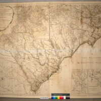
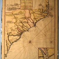
An Accurate Map of North and South Carolina, with their Indian Frontiers
Engraved map made of eight joined sheets: An Accurate Map of North and South Carolina with their Indian Frontiers, Shewing in a distinct manner all the Mountains, Rivers, Swamps, Marshes, Bays, Creeks, Harbours, Sandbanks and Soundings on the Coasts;…
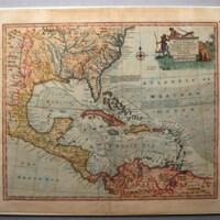
An Accurate Map of the West Indies…
Hand-colored engraved map: An Accurate Map of the West Indies. Drawn from the best Authorities, assisted by the most approved modern Maps and Charts, and Regulated by Astronomical Observations. By Eman: Bowen. [cartouche]. | No. 57 [lower left,…
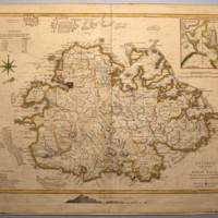
Antigua
Engraved map made of two joined sheets: Antigua Surveyed by Robert Baker Surveyor General of that Island by Thomas [J]efferys Geographer to the King. [title, lower right inside neat line]
Thomas Jefferys (ca. 1710-1771) was an engraver, geographer,…
Thomas Jefferys (ca. 1710-1771) was an engraver, geographer,…
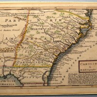
Carolina
Hand-colored engraved map: Carolina. By H. Moll Geographer [Cartouche, lower right] | The English claim the Property of Carolina from Lat. 29 &c. Degrees as part of Cabot’s Discoveries who set out from Bristol in 1498, at the Charge of King Henry ye…
Carte General de la Caroline…
Engraved map: Carte General de la Caroline Dresse fur les Memoires le plus Nouveaux Par le Sieua S[anson] A Amsterdam. Chez Pierre Mortier Libraire Avec Privilege de Nos Seigneurs les Etats [cartouche] | Inset of Charles Town harbor showing the…
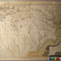
A Compleat Map of North Carolina from an actual survey
Hand-colored, engraved map made of two joined sheets: A Compleat Map of North Carolina from an actual Survey. By Captn Collet, Governor of Fort Johnston. Engraved by I. Bayly. [across top of map, above neat line] | To His Most Excellent Majesty…
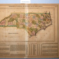
Geographical, Statistical and Historical Map of North Carolina
Hand-colored, double-page, engraved map of North Carolina showing the individual counties. NORTH CAROLINA. [title] | GEOGRAPHICAL, STATISTICAL AND HISTORICAL MAP OF NORTH CAROLINA No. 23 [top, outside neat line] |“Drawn by F. Lucas, Jr. [left,…
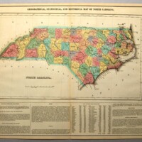
Geographical, Statistical and Historical Map of North Carolina
Hand-colored, double-page, engraved map of North Carolina showing the individual counties: NORTH CAROLINA. [title] | GEOGRAPHICAL, STATISTICAL AND HISTORICAL MAP OF NORTH CAROLINA No. 23 [top, outside neat line] | Drawn by F. Lucas, Jr. [lower…
Geography
Hand-colored engraving: Geography [title]. | To the Rt Honble George Berkeley Ld Berkeley, Mawbray, Seagrave & Bruce, Baron of Bruce Castle, & Earle of Berkeley, & one of the Lords of his Majestyes most Honble Privi Councell &c. Anno Dom. 1678 This…
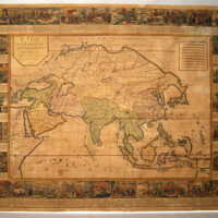
L'Asie…
Colored, engraved map, made of two joined sheets: “L’Asie Divisée selon tous ses Etats Empires et Royaume &c. Dressèe sur differents memoires. A Lyon Chez Daudet rue mercierre 1752.” (Translation: Asia divided according to states, empires and…
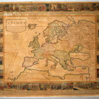
L'Europe…
Colored, engraved map made of two joined sheets:“L’Europe Divisée Selon L’Etendue de Ses Principaux Etats Et subdivisés en leurs principales Provinces Dressèes sur differents memoires. (Translation: Europe divided according to the scope of its…
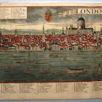
London
Large hand-colored engraving, made of two joined sheets: London [banner center top] | Cum gratia et Privilegio Sac. Caes: Majestatis [upper left, outside neat line] | Georg Balthasar Probst, exec: Aug. V [lower right, at plate line]. | No 41…
Map of New Berne, N.C. and Defenses…
Colored lithograph: Map of NEW BERNE, N. C. and DEFENSES. Copied from Cleveland Rockwell’s U.S. Coast Survey Chart of New Berne and Approaches, with additions under the direction of Lieut. Wm R. King, U. S. Engirs by Solon M. Allis, 27th Mass., July…
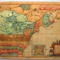
A Map of the British and French Settlements in North America
Hand-colored, engraved map: Map of the British and French Settlements in North America. Univ. Mag. T. Hinton Newgate Street [cartouche] | Inset: Fort Frederick at Crown Point built by the French 1731 [inset, center bottom.]
Map shows North America…
Map shows North America…
Navigation
Colored engraving: Navigation [title] | To ye Honble Arthur Herbert Esqr Admiral and commander in chiefe of his Majestys fleet in ye Mediterra=nean and one of the Commissioners of the Admiralty &c. This plate is Humbly dedicated by Ricd Blome. [top…
Position: 5 (255 views)
