Browse Items (1043 total)
Sort by:
Battlefield of NewBerne, N.C.

A map of the battlefield for the Battle of New Bern on March 14, 1862.
Position: 707 (72 views)
Baskervill Family Bible
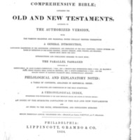
The Comprehensive Bible; containing the Old and New Testaments, according to the Authorized Version...Philadelphia: Lippincott, Grambo & Co., 1854.
Position: 327 (104 views)
Bank of New Bern, 300 block Pollock Street, south side, ca. 1971
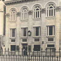
A 1971 view of the Bank of New Bern building at 313 Pollock Street.
Position: 491 (86 views)
Bank of New Bern
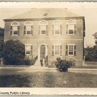
Photographed is the Bank of New Bern built in 1819. A man is standing in front of the doorway. A bicycle is propped against the brick fence.
Position: 349 (101 views)
Bank Loan from Bank of North Carolina
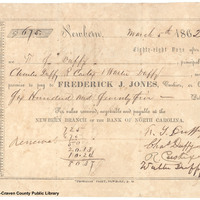
The document written is a promissory note payable to the Bank of North Carolina for $675 from F. S. Duffy (principle), Charles Duffy, R. Castix, and Walter Duffy (sureties). This payment is given to the cashier Fredrick J. Jones.
Position: 305 (109 views)
Bailey-Whitehurst Family Bible
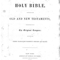
The Holy Bible, containing the Old and New Testaments, translated out of The Original Tongues; and with the Former Translations Diligently Compared and Revised. New York: American Bible Society, 1853.
Position: 1 (775 views)
Babe Ruth with game at Camp Bryan
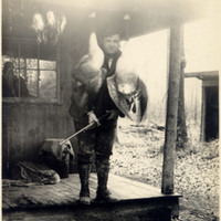
Carraway writes on the back of the photograph: "Babe Ruth again bags game in eastern North Carolina."
Position: 1036 (21 views)
Babe Ruth at Camp Bryan with deer
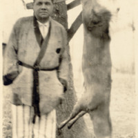
"Babe Ruth in pajamas with his early morning deer shoot in East North Carolina at Camp Bryan."
Position: 1027 (23 views)
Babe Ruth at Camp Bryan
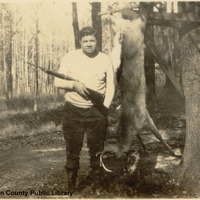
Carraway writes on the back of the photograph: "Babe Ruth again proves a marksman with a gun, killing a big deer December 5 near Camp Bryan in east North Carolina, where he is on his annual hunting trip."
Position: 1046 (17 views)
Babe Ruth and Party
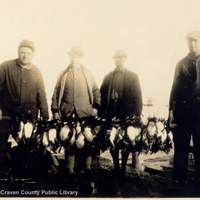
"Babe Ruth and party on a duck hunt in East Carolina. He brought down a big deer and many ducks and geese."
Position: 1041 (20 views)
Babe Ruth and Frank Stevens at Camp Bryan
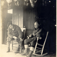
"Babe Ruth, Home-Run King, and Frank Stevens, Hot-Dog King, of New York, plan with one of their six hounds for a hunt from Camp Bryan near New Bern, N.C. Above may be seen some of the 31 ducks that their party bagged on the southern trip. They also…
Position: 1036 (21 views)
Babe Ruth and Frank Stevens at Camp Bryan
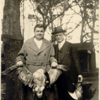
Babe Ruth and Frank Stevens show the results of their hunt at Camp Bryan.
Position: 1036 (21 views)
Babe Ruth and Frank Stevens
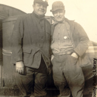
"Babe Ruth and Frank Stevens enjoy a ten-day hunting trip in eastern North Carolina."
Position: 1041 (20 views)
Babe Ruth and doves
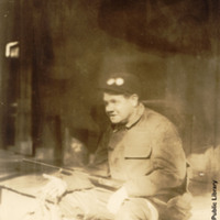
"Babe Ruth and a dozen doves he killed shortly after arriving at Camp Bryan in eastern Carolina for his annual hunting visit."
Position: 1027 (23 views)
B.F. & S.F. Watson Family Bible
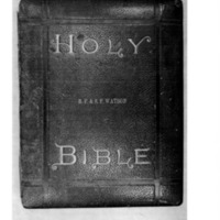
The "Standard" edition of the Holy Bible containing the King James and the Revised Version of the Old and New Testaments Arranged in Parallel Columns...B.F. Johnson & Co., Richmond, Va.
Position: 520 (84 views)